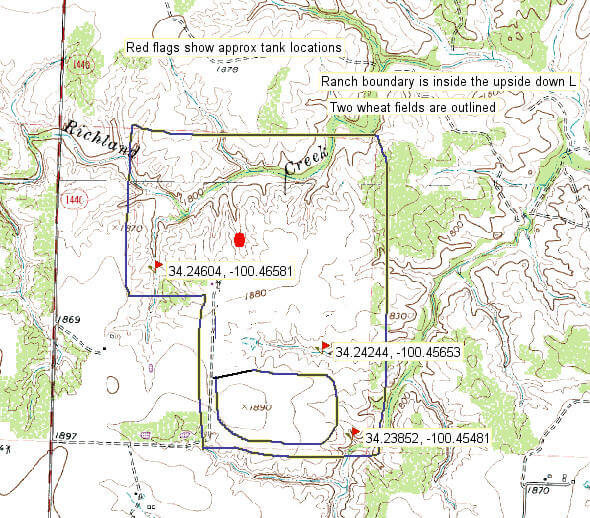
The big red dot on the topological map is our house overlooking the canyon and Richland Creek. The following topographical map shows the layout of the ranch and gives you a feel for the topography of the Southern Rolling Plains.
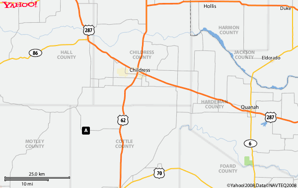
The following Yahoo map shows the approximate location of the ranch with the “A” in the black box. The ranch is actually at the top of that black box (County Road 188 is not shown on this map). The big river in Harmon county is the red river between Oklahoma and Texas. Highway 287 is the road most Texans take to Colorado and is the reason many people know where Childress is located. Amarillo is 125 miles west northwest and Wichita Falls is 125 miles east southeast of Childress. You can see by the lack of roads on the map that there are not many people living in this rural area, which is one reason we like it.